3D Visualization of Digitized Maps
This application displays digitized maps as a texture on a 3D model. The maps have to be georeferenced and provided via WMS or TMS. If that is not the case, the maps can be converted to WMS using the WMS conversion application.
A reasonably recent internet browser supporting WebGL is required to view the results. Internet Explorer 11+, Mozilla Firefox 4+ and Google Chrome 9+ all support WebGL. You can also check whether your system supports WebGL on this page.
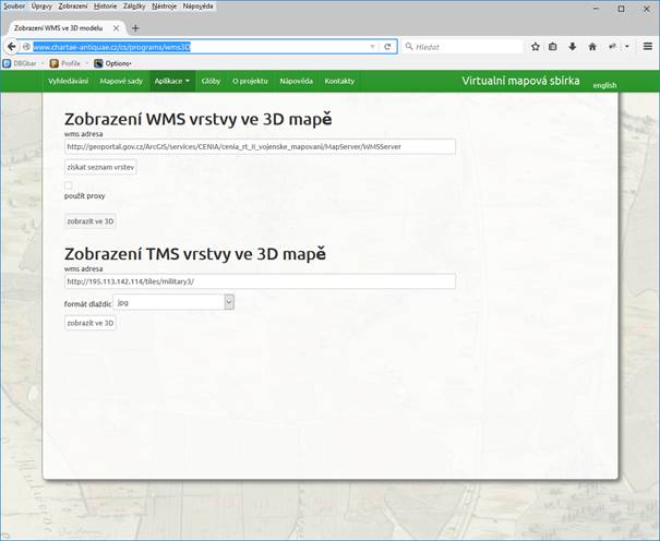
Image 1: application home page
Display WMS layer in 3D
Fill in the WMS URL into the form field and push the Fetch layer list button. The application will fetch information from the WMS and display a list of the included layers. It will also check whether it's necessary to use a proxy to account for missing cross-origin headers. Using a proxy results in a somewhat slower experience, as the data have to be effectively transferred twice (to the proxy server and then to the user).
Select the desired layer(s) from the list and push the Display in 3D button. A new browser window will open with a viewer application displaying the map on a 3D model.
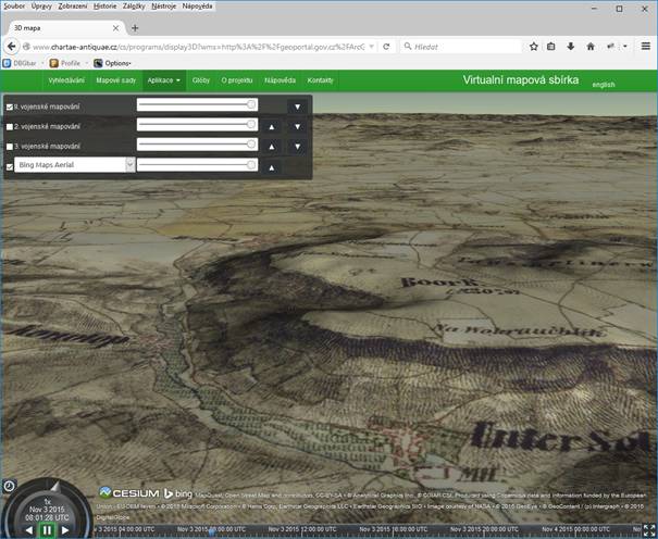
Image 2: WMS map on a 3D model
Display TMS layer in 3D
Fill in the TMS URL of the map. The resource must use the same tile format as OpenStreetMap, otherwise the layer will not display on the model. Then push the Display in 3D button to open a new browser window with the map displayed in a viewer application.